Chipe Rabadilla Amarilla
La traducción en Español pronto estará disponible.
About the Map
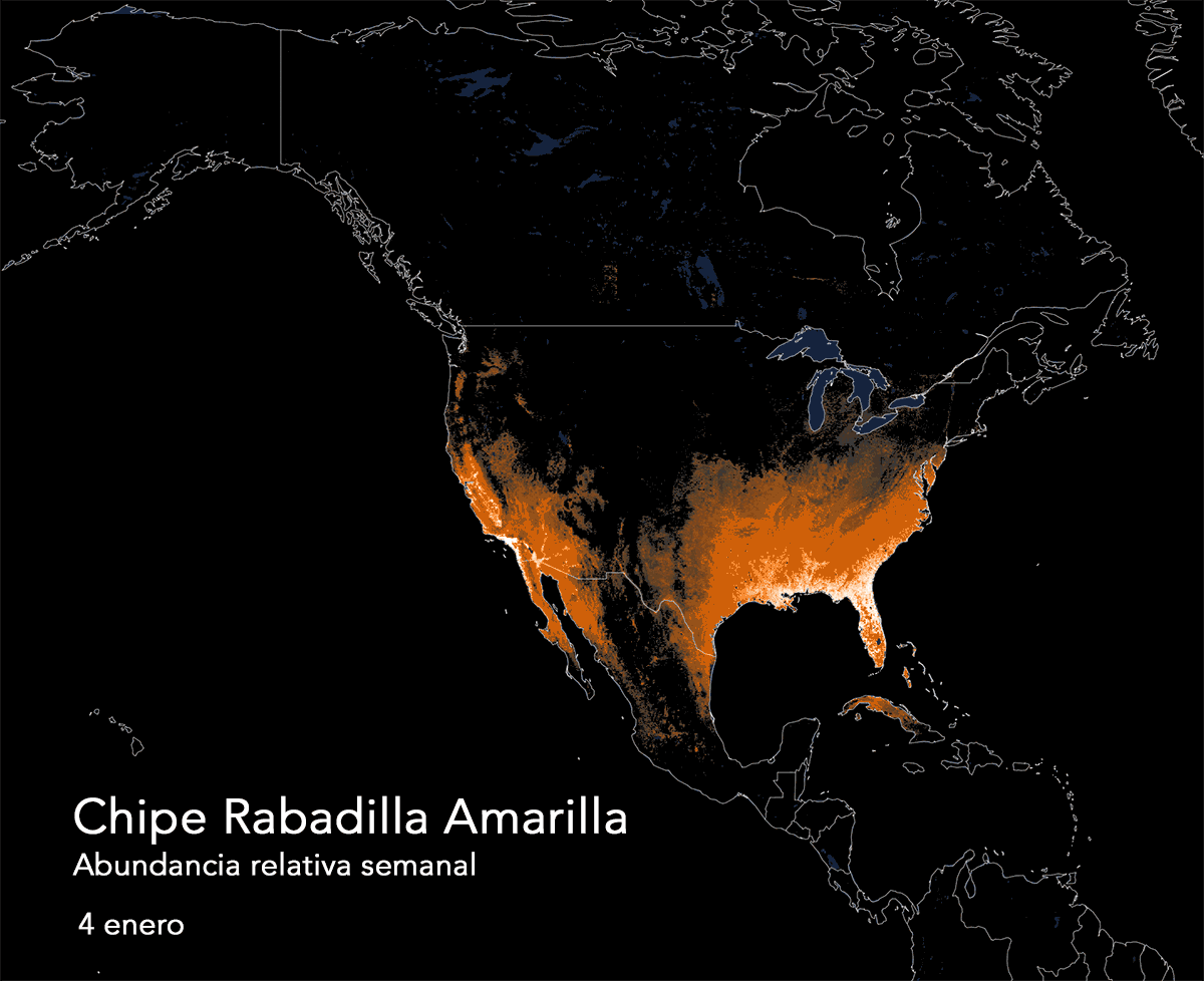
The animated map shows the Yellow-rumped Warbler’s predicted distribution and relative abundance across all 52 weeks of the year. The animation illustrates the migratory movements of each species as its populations travel across North America. The brighter the color, the higher the expected count of the species on a standardized eBird count.
The data used to generate this animation were produced using a statistical model to predict the relative abundance of the population at specific times and locations by relating observations of birds from eBird to local environmental features derived from NASA remote sensing data. Please note that because these maps represent models of predicted abundance, they are shown to illustrate broad patterns of connectivity across regions and are not intended to accurately depict local distributions in any given week. As more and more eBird data become available, the accuracy of these predictive models will improve.
About Yellow-rumped Warbler Abundance and Distribution
The Yellow-rumped Warbler is one of the most abundant birds in North America, connecting almost every part of Canada, the U.S., and Mexico during its annual cycle. The northern and eastern population (“Myrtle Warbler”) breeds throughout the boreal forest of Alaska and Canada, migrating east and south to spend the winter primarily in the southeastern U.S.—small numbers reach eastern Mexico and the Caribbean, especially during cold northern winters. The western population (“Audubon’s Warbler”) breeds in coniferous forests of the western U.S. and southwestern Canada and winters in the southwestern U.S. and in the highlands of central and western Mexico. Yellow-rumped Warblers are tolerant of disturbed habitats; eastern populations have been stable or increasing, whereas western populations have shown a steady decline since 1970.
More about Yellow-rumped Warbler at All About Birds.